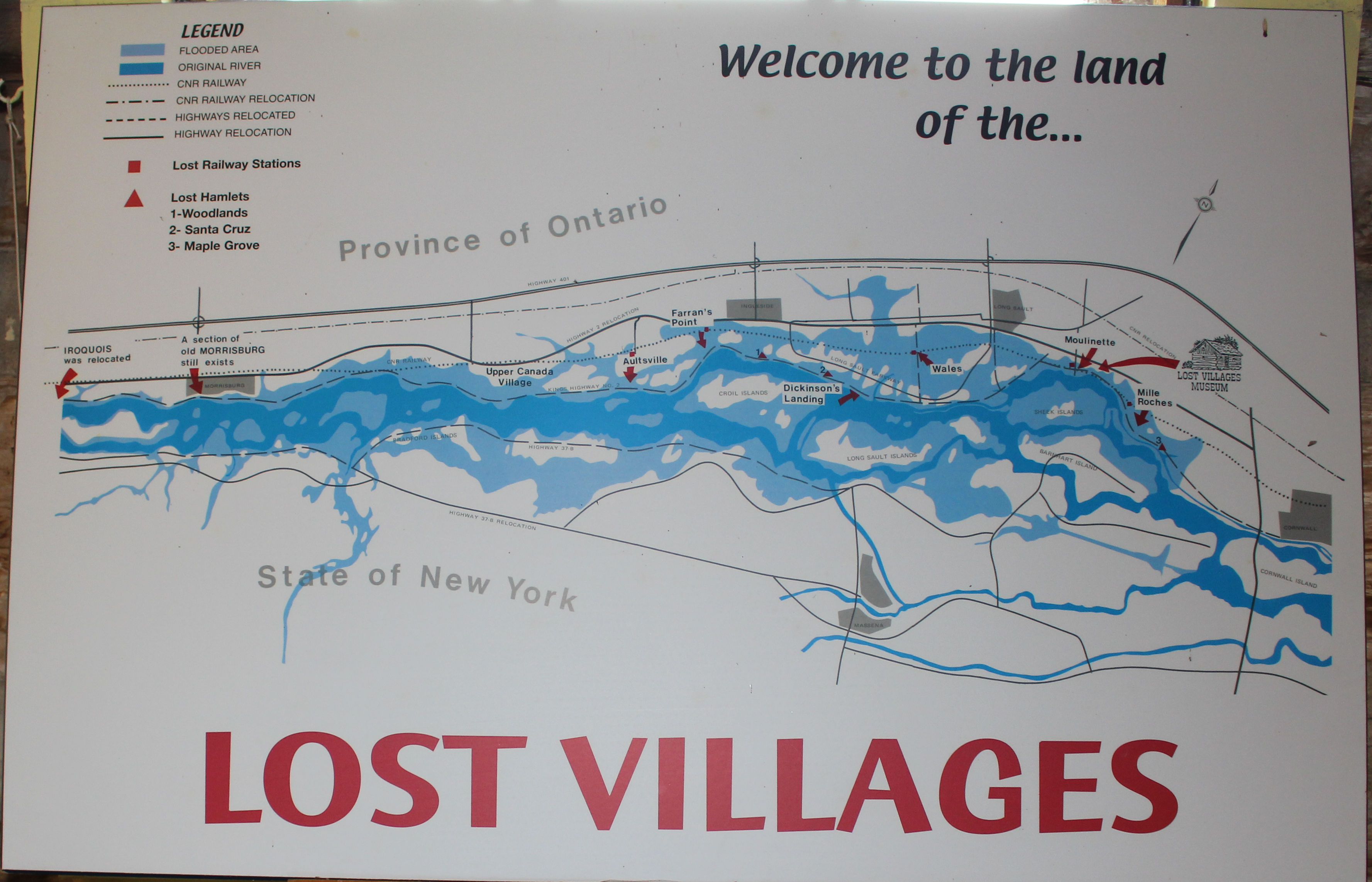
In the name of progress a number of Eastern Ontario communities were basically wiped off the face of the earth for the construction of the St. Lawrence Seaway and Power Project. The dark blue on the map above shows the original river and the lighter blue shows the ‘new’ river after flooding.
People lost their homes and their livelihoods. Some houses were moved but the majority were either torn or burnt down but their foundations remain.
Zooming in on the google earth image of the area, you can see the old highway and rail line and how much land is now submerged.
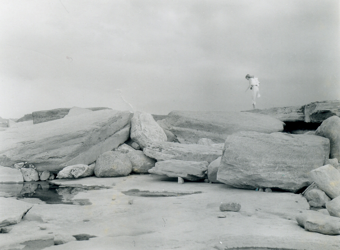
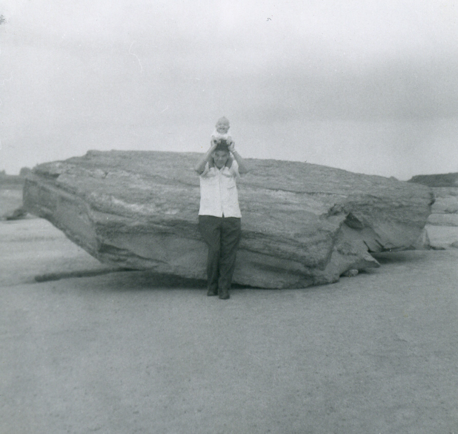
The following three pictures were taken in August 1957 when the rapids at Long Sault were drained.
my mum walking on the once submerged boulders of the rapidsme on my dad’s shoulders at one of the once submerged boulders of the rapidsme on my dad’s shoulders at a stack of once submerged boulders of the rapids
According to what my mum wrote on the backs of these photos, I was only 9 months old at the time.
I definitely don’t remember seeing the rapids drained but I do remember after the flooding. We lived near Maitland, ON far enough west that the effects of the seaway construction weren’t felt, but close enough to make it a nice Sunday drive.
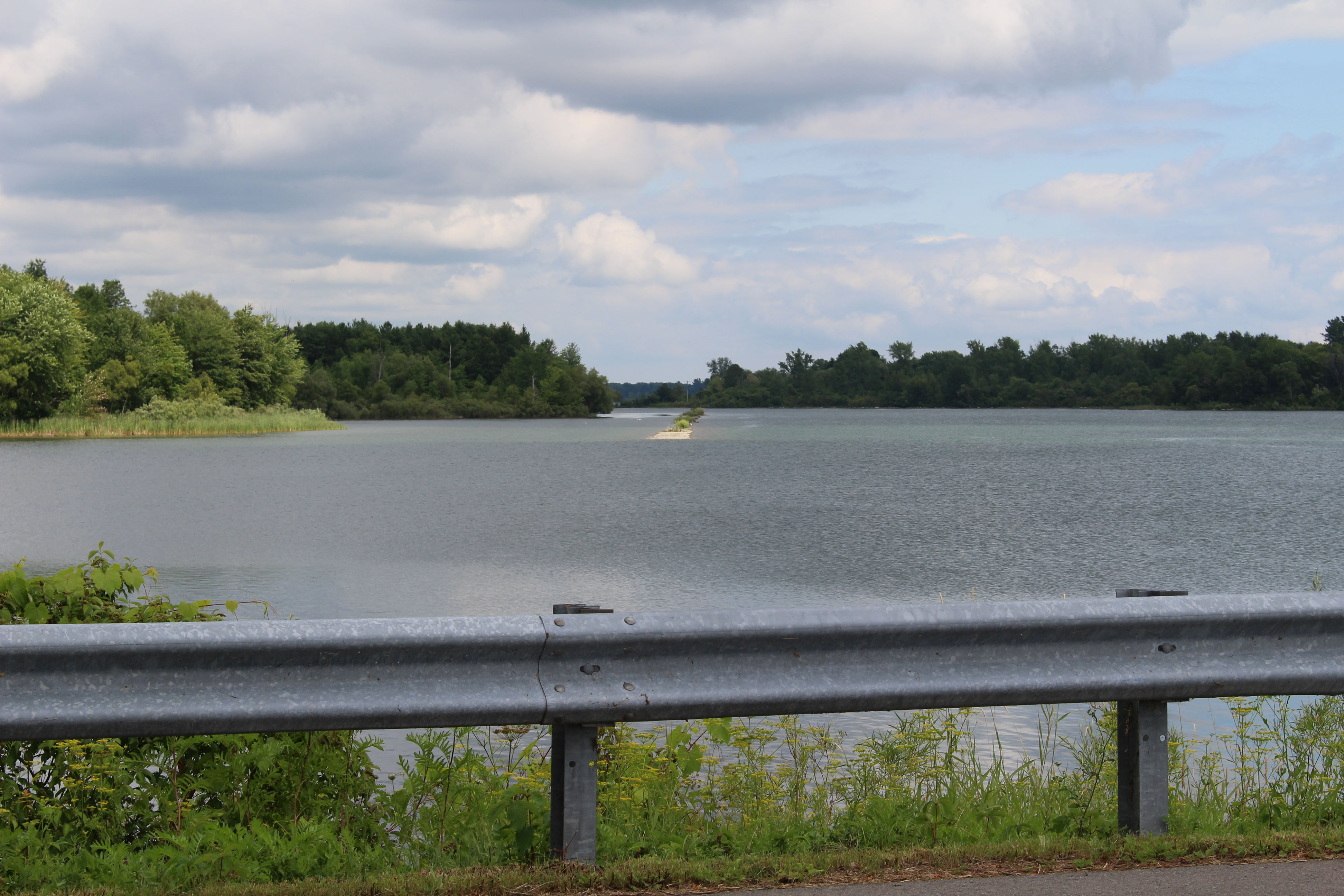
the old highway disappearing under the water and reappearing on the other side
I do remember scenes similar to this one in the photo I took in July of this year. As a child, I remember having nightmares about the road disappearing under the water never to be seen again but I didn’t know at the time where it was.
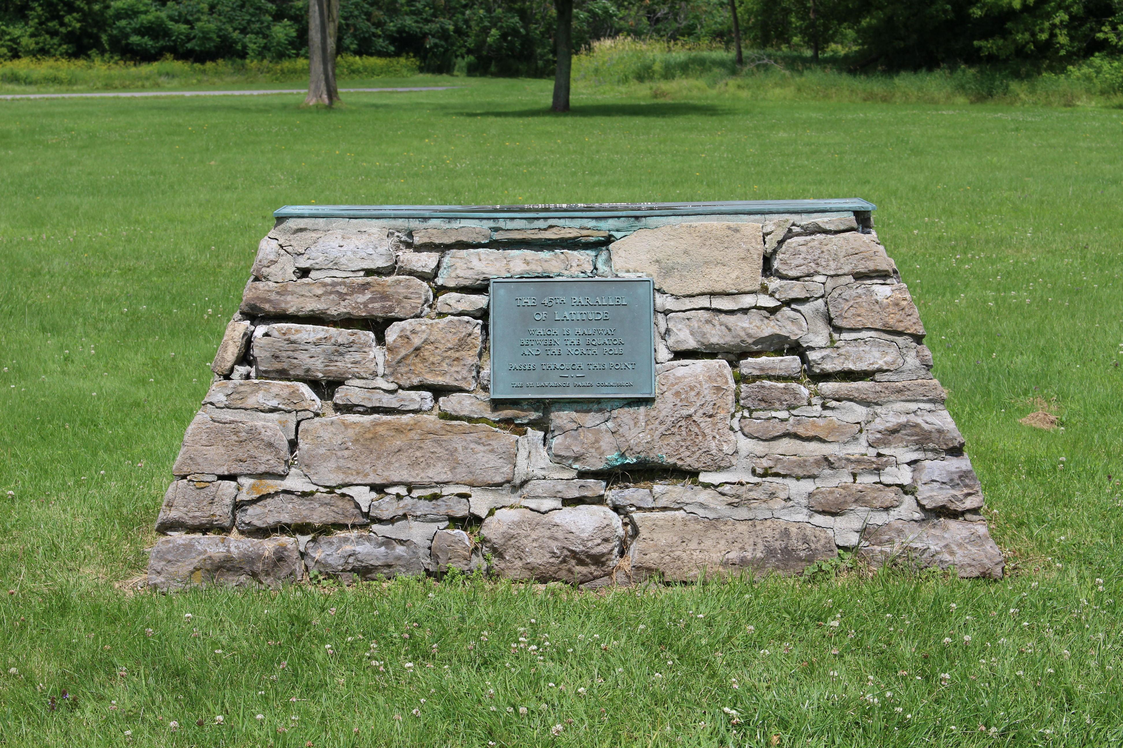
Bridges and causeways were built to join the islands created due to the flooding and became part of the St. Lawrence Parks Commission. The road joining them is known as the Long Sault Parkway.
The scenic drive is free but to stop at any of the beaches or campgrounds or even the 45th parallel, you have to buy a pass.
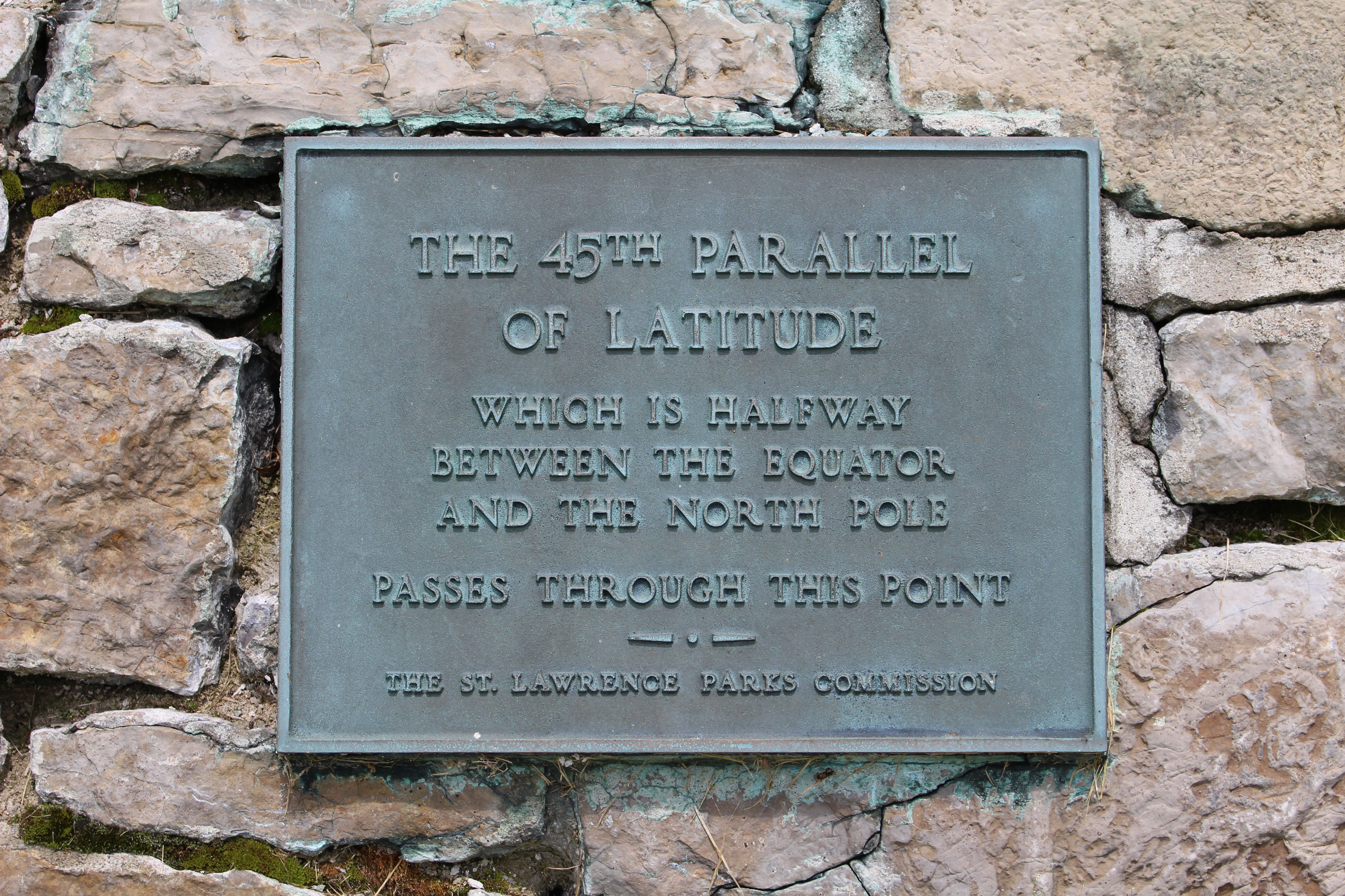
45th parallel cairn on McDonell Islandcloseup of the plaque on the 45th parallel cairn
The old CN line (formerly the Grand Trunk Railway) in the photo below is part of the Waterfront trail. I had taken photos from the same side of the road but after I crossed to see if I could see where the rail line reappeared, the sun came out from behind a cloud and illuminated it perfectly.
the old rail line between the mainland and West Woodland Island
With so much land now being under water, wouldn’t this location make a great place for a murder? Maggie Wheeler thought so and used the area of the Lost Villages for her Farran MacKenzie murder mystery series.
Maggie will be my special guest on September 19th. Mark your calendar for that date so that you don’t miss it.
My Scottish roots and writing by Melanie Robertson-King

 I hope you’ll stop by on Sept 19th to find out what we’ll be talking about.